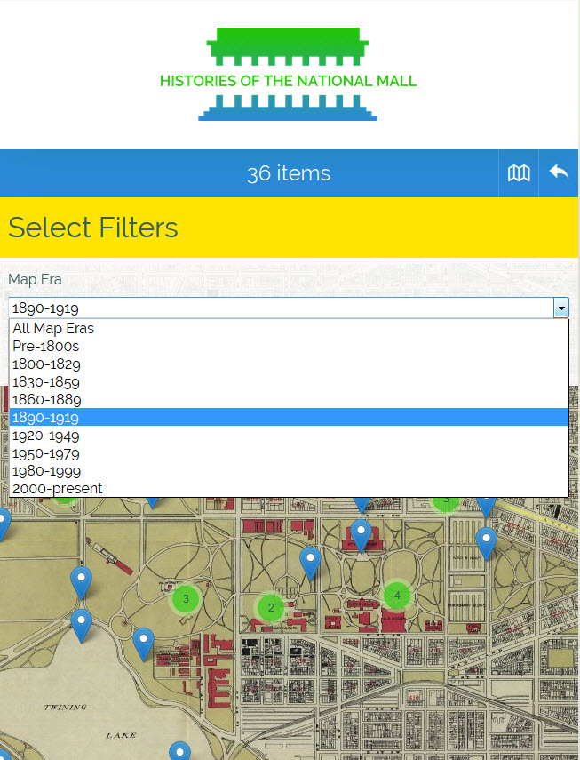
Representing change over space and time were important goals for this project. We began by investigating different mapping and geospatial platforms that would allow users to see how the Mall’s landscape and environment changed through historic maps. First, the team needed to find multiple maps appropriate for layering onto a base map of today’s Mall to allow for comparison and contextualization. This was a challenge, because there are many types of maps, architectural drawings, and plans of the space now identified as the National Mall. Many of those “maps” illustrate the Mall, but do not actually represent real proportions, or come close to points of latitude and longitude. The Project Manager spent weeks researching to find historic maps that represented different stages in the Mall’s development, existed as high-resolution image files, and could be georectified.
We had to balance our commitment to incorporating accurate historical map layers with concerns about the user experience. The mapping experience had to be optimized for our primary audience, visitors on the Mall, meaning we needed a light-weight software solution that would not crash mobile browsers. If the mapping section took multiple minutes to load, users would likely abandon the site in frustration. This critical requirement eliminated many mapping toolkits, even ones built specifically for Omeka. This challenge led our lead developer to select the Leaflet.js libraries on which to build a custom mapping plugin, that worked closely with the existing Omeka geolocation plugin.
Read more about the mapping experience from developer Jim Safley and how he developed the custom map plugin while working closely with web designer Kim Nguyen.